LSDMS 1.0

Free System used to capture and verify survey data spatially
5 
Rating
Your vote:
Latest version:
1.0.4 See all
Developer:
Screenshots
1 / 1
Freeware
Download
Free  
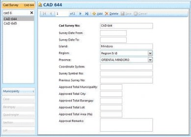
LSDMS is a Land Survey Data Management System used to capture and spatially display survey data for accuracy verification. The Regional Land Management Service of the Department of Environment and Natural Resources manages the system.

Land Survey Data Management System (LSDMS) is an application system used for capturing survey data and presents it spatially to verify its accuracy. The system shall be managed by the Regional Land Management Service of the Department of Environment and Natural Resources.

Comments

5 stars
3
4 stars
0
3 stars
0
2 stars
0
1 stars
0
User

Your vote: